Category Archives: Wild landscapes

Doubtful

Doubtful Creek

Doubtful (Click to view larger image)

The place names of the Snowy Mountains region have always seemed very special. For me at least, they have a romantic, even magical resonance in their sounds and the feelings that they evoke. Names like ‘Bogong’, ‘Monaro’, ‘Crackenback’, ‘Dead Horse Gap’, ‘Perisher’, ‘The Dargals’, ‘Pugilistic Creek’, ‘Dicky Cooper Bogong’, ‘Sue City’ – they conjure up images and stories of times past, and the various narratives of the Aboriginal peoples, the early European explorers and pastoralists, the workers of the Snowy Mountain Hydro Scheme and the skiers and hikers of modern times.

But the contemporary names, which are now fixed and codified by the Geographic Names Board (for NSW) conceal a history of confusion, change, and contention as European society struggled to impose a set of names onto the landscape which had managed to exist quite satisfactorily without labels on every locality and topographic feature.

There are many difficulties in establishing the names used by the Aboriginal peoples in the Snowy Mountains region (and similar problems in many other places too). The Indigenous naming system was not like that of the Europeans colonists.

There were more than 300 different language groups across the continent prior to European colonisation, and several groups that converged on the Snowy Mountains (especially for the summer Bogong moth migration), probably including speakers of Ngunawal, Ngarigo, Yuin, Walgalu, Bidawal and Jaithmathang languages. So one place may have had different names in different languages. One place (especially rivers) may have had several different names. A name may have been applied to a particular geographic feature as well as to the surrounding region, and some names may have had a secret or sacred dimension, and be known only to particular members of the group. Place names were often used to indicate the value or resources available from that location (‘Bogong’ is probably a good example of this). And further, land and mythology are inextricably related, and place names were often used to access the spirit and ancestor stories about places to which they are attached. (See the Our Languages website for further discussion of indigenous place names.)

When Europeans arrived in the region they generally sought to learn the local names for places from its inhabitants. This attempt was fraught with potential for error, however, for all of the reasons above. In the Monaro and Snowy Mountains regions, it soon became difficult due to the rapid decline in the indigenous population, and the disruption of their culture following the colonial settlers’ appropriation of their land. Also, Aboriginal words were often poorly transcribed into English text, and descriptions of places (e.g. ‘pretty’ or ‘resting place’) could be erroneously recorded as place names. The early European visitors themselves delighted in giving their own new names to places in the Snowy Mountains, blithely unaware of other names that may have been applied by earlier visitors.

A contest of names ensued, which can be also seen as a contest for dominance between the narratives and interests of the groups who supported different names. One result is that it can be quite difficult now to reconstruct the journeys of travellers to the region in the 1800s, as the place names they used may not have been recognised by anyone other than themselves! Our ‘modern’ “Mount Jagungal”, for example, has been variously referred to as ‘Bluff Hill’, ‘Big Bogong’, ‘Targil’, ‘Teangal’, ‘Jar-gan-gil’, ‘Corunal’ and ‘Coruncal’.

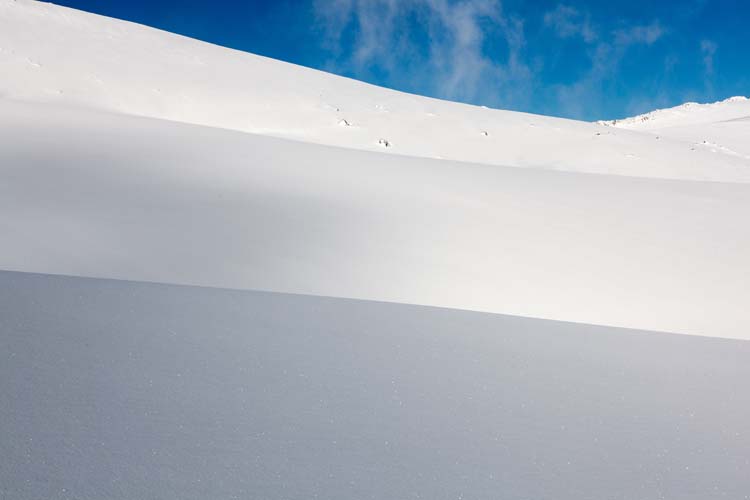
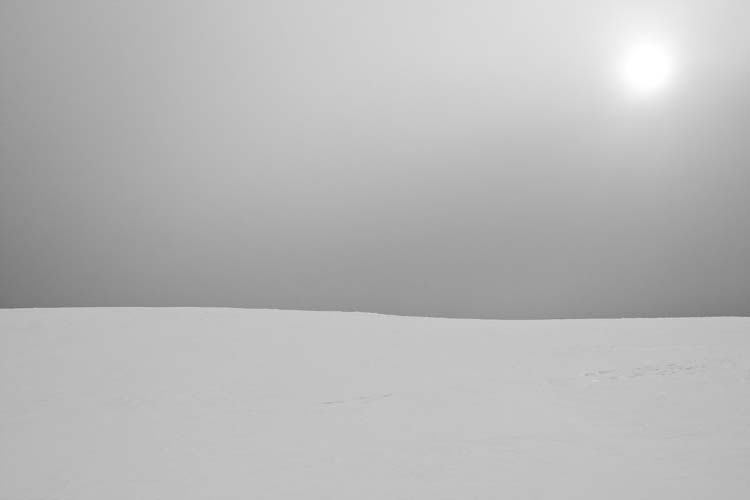
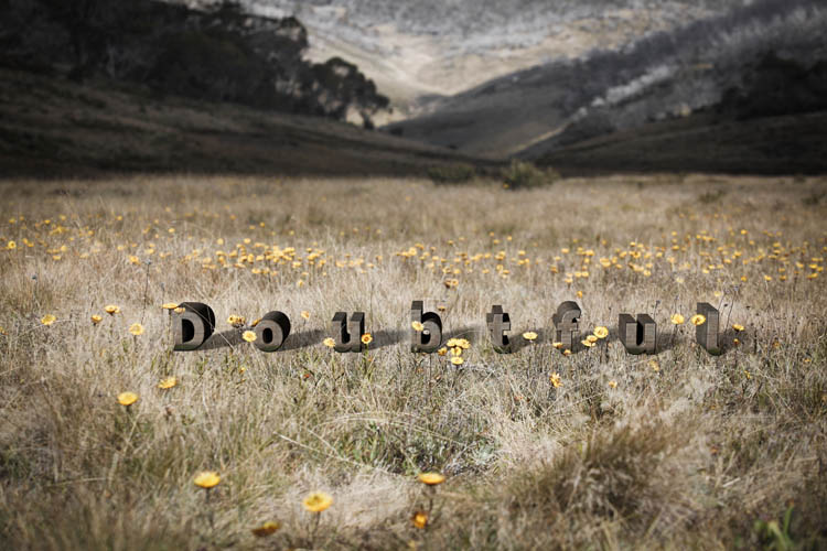
In my Doubtful image, I wanted to allude (perhaps somewhat obliquely) to this state of confusion and the contested history of place names in the region. “The Doubtful” is in fact the ‘official’ name of a real creek near Mt Jagungal. The Geographic Names Board describes it as “a watercourse about 19km long. It rises about 2 km NNW of North Bulls Peak and flows generally N into Tumut River.” For me it has extra significance as it runs adjacent to (my grandfather) Archibald Rial’s hut at Farm Ridge. Family legend has it that he (or his workers) panned the gold for my grandmother’s wedding ring from that creek.

Alan Andrews, in Kosciusko: the Mountain in History (O’Connor, Tabletop Press, 1991) suggests that its name might derive from the surveyor Thomas Townsend’s uncertainty in 1847 as to whether it flowed into the Tumut or Snowy River systems. (I haven’t looked too hard for a more definitive derivation of the name, as I rather like the uncertainty.)

In the Doubtful image, the letters of the word ‘Doubtful’ are not embedded in the landscape but placed on top of it. The letters are widely spaced, and in mixed case so as not to appear overly authoritative. The landscape itself was photographed with very shallow depth of field, to further accentuate the sense of uncertainty.

No message

I’ve been reading a little about the functions and mechanisms by which ‘signs’ (in the broadest sense of the word) operate. Icon, index and symbol, and the often impenetrable language of the semioticians. But some of the most obvious and bluntly direct signs are all around us in the form of advertising in public spaces as posters, advertising hoardings and billboards. In public urban spaces they are so ubiquitous that most of the time we don’t even notice their presence.

I have been looking at a lot of them lately, both in downtown locations and alongside highways, and I’ve been overwhelmed by the sheer number of them. Normally, they reach us (if at all) as just an element of background visual noise. Our gaze, the gaze of the contemporary citizen-consumer, both sophisticated and distracted, is usually directed elsewhere. Combating our neglectful tendency to ignore, these signs vie for attention through size, shock, visibility, repetition or saturated presentation. Through their style or location they attempt to reach (though ‘target’ is perhaps a better word for it) their desired audience/market segment.

Usually they are straightforward, even crude, in their expression of a simple message from the source (advertiser) to the recipient (viewer). The message is: “You need/want this product. Buy it.” Or:; “Change your behaviour or attitude take action in line with the advertiser’s wishes.”

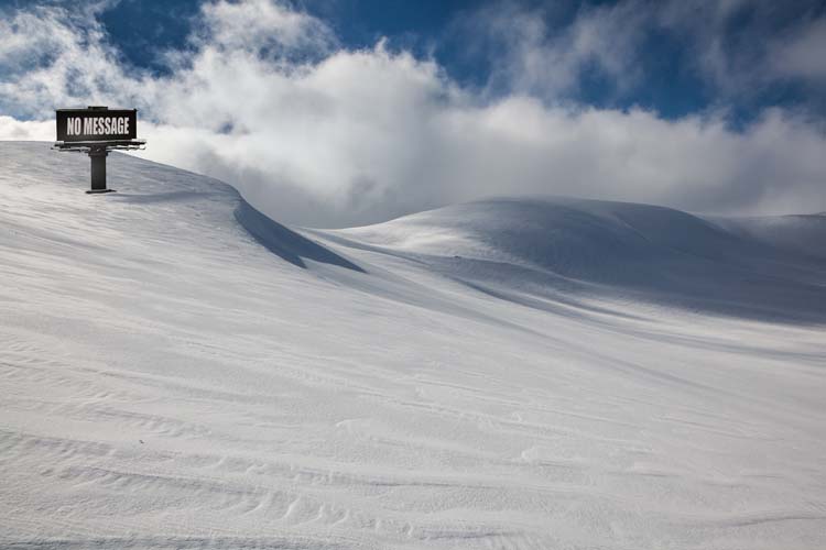
No message

"No message" (5616 x 3744 pixels)

In this image of a standard (14′ by 48′) roadside image in a wilderness snowfield near Mt Kosciuszko, I wanted to make the billboard to itself become visible as an object, rather than as the almost-invisible vehicle for delivery of messages to a mass audience.  In a way it’s a McLuhan-esque effort to put the message to one side and focus solely on the medium.  I also sought to ask two questions of the viewer.

Firstly, if removed from its audience, and relocated in an environment without viewers, what happens to the sign? Does it continue to have meaning? It retains a physical presence and the capacity to express a message – but can it be said to have a message if it has no audience? This resembles the old pop-philosophical question:  if a tree falls in a wilderness forest with no-one there to hear it, does it make any noise?

It could of course be said that the billboard sign does have an audience i.e. us, the viewers of the reproduced photographic image. However we view only a picture of the billboard and its message. It is a ‘sign-within-a-sign’, or a ‘sign-about-a-sign’ i.e. a ‘meta-sign’. It is  at least one degree of abstraction removed from the ‘real’ sign and its message. (In fact it is even less than that, as it is only a contrived Photoshop 3D model of sign,  an ‘object’ which has never had existence in physical space!)

And the second question is: what might this then reveal about the mechanisms by which these objects function in their conventional human environment?

Mt Townsend

I had a great trip recently, snowshoeing from Crackenback (above Thredbo) to Mt Townsend. It was mid-week (no-one else out there), there had been about 20cm of fresh snow the night before (creamy smooth snow with no tracks) and the weather was glorious (sunny cold and some nice dark clouds coming in from the west during the afternoon).

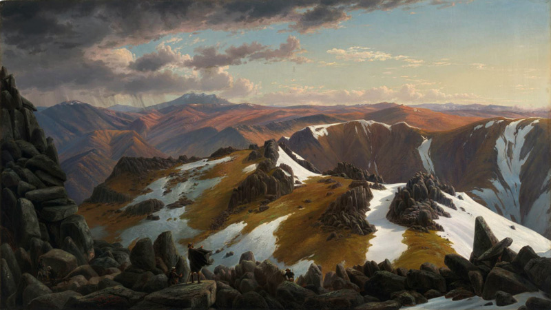
One purpose for the trip was reconnaissance; I have long admired Eugene Von Guerard’s painting Northeast View from the Northern Top of Mount Kosciusko (which is actually a view from the top of Mt Townsend).

It depicts a panoramic view from near the summit of Mt Townsend in the main range of the Snowy Mountains, looking northeast across Lake Albina and the Watsons Crags to Mt Twynam and Mt Jagungal in the distance. Shown in the central foreground are the members of German scientist Georg von Neumayer’s 1862 expedition team (including Hector the dog) which was undertaking a magnetic survey of the colony of Victoria. A storm, which later visited extreme and almost catastrophic conditions upon the party, can be seen approaching from the left background Apart from the pile of boulders in the left foreground, which do not exist in the actual location, the scene is shown with a fair degree of topographical accuracy

Eugene von Guérard, North-east view from the northern top of Mount Kosciusko (1863)

Eugene von Guérard, North-east view from the northern top of Mount Kosciusko (1863) - National Gallery of Australia

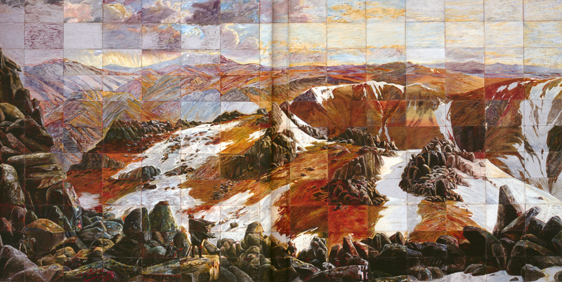
The painting was also appropriated by Imants Tillers in a 1985 painting (actually done as 165 separate canvas board panels) entitled Mount Analogue.Mount Analogue

Imants Tillers, Mount Analogue (1985) – National Gallery of Australia, purchased 1987. Painting, oil, oil stick and synthetic polymer paint. 279.0 h x 571.0 w cm

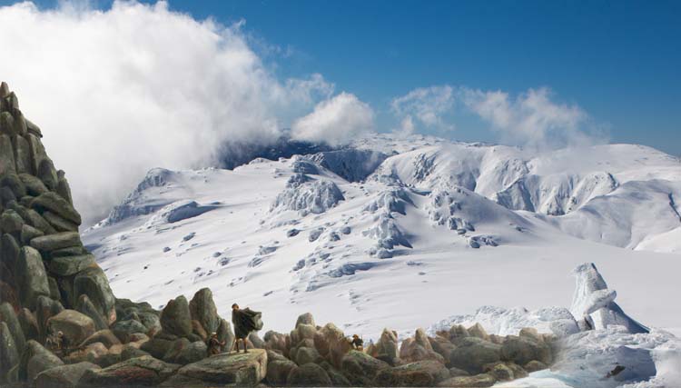
I’ve got this idea of reproducing this image as a photograph on 19 November this year – which will be exactly 150 years after Von Guerard was there. So part of my aim was to confirm the location of the painting’s vantage point, check lens options (I found the Canon 24-70 2.8L got the aspect about right) – and of course to make some images while I was there!

So here’s my mid-winter version of the scene (with the made-up bits of Von Guerard’s scene added in):Homage to Eugene Von Guerard and Imants Tillers

Homage to Eugene Von Guerard and Imants Tillers

The light was quite lovely the day I was there, especially as the clouds came up in the afternoon and chased me back to Crackenback, and I got nice images along the course of my 8 hours of tramping through the snow. I’ve reproduced a few of them below, but you can see the full set on the main Jokar web site at this link. Hope you like them!

Mt Townsend

Slopes of Muellers Peak

Descending from Mt Townsend

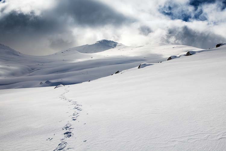
Looking back at Mt Townsend (my tracks in the snow)

Above Seaman's Hut

Between Seaman's Hut and Rawson Pass

Winter Postcards exhibition

PhotoAccess is currently showing an exhibition of work by no less than 32 photographers. It’s called Winter Postcards, and as the name suggests all of the works must be postcard size (i.e. 6″ x 4″), with each exhibitor able to show up to 10 images.

The brief for the exhibition is very broad, with the only requirements being that the images should relate somehow to the winter theme – even if they are images of travel to warmer climes to escape the chilly Canberra winter – and that each set of images should work as a group.

I submitted 10 images under the title of “Alpine“. They are all snowy landscape images, with signs of human presence in several of them. Most have been taken in the Snowy Mountains region at some point over the past several years, though there are also two from New Zealand, from when I did a mountaineering course there a few years ago.

Alpine 1 - Ramsheads campsite

Alpine 2 - near Kosciuszko, just before the storm arrived

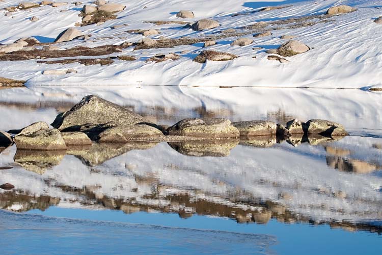
Alpine 3 - Hedley Tarm reflections

Alpine 4 - Approaching Cootapatamba Hut

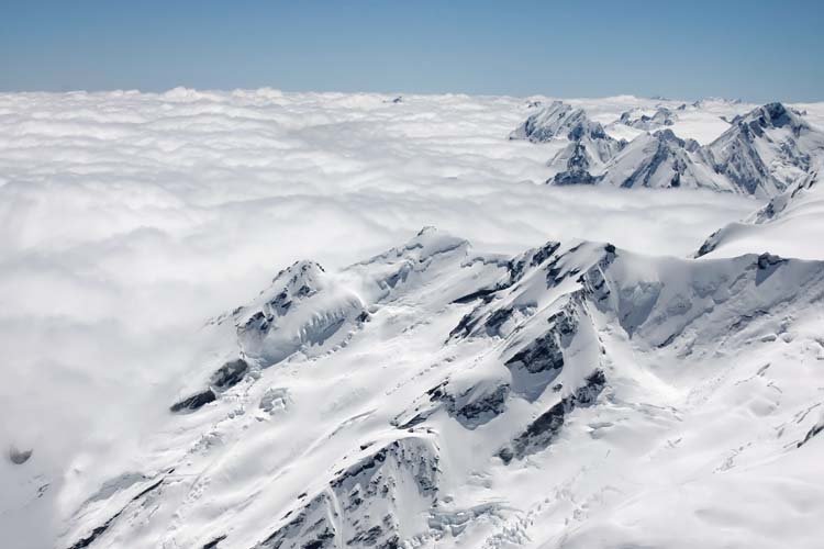
Alpine 5 - View from Kelman Hut (NZ)

Alpine 6 - snowshower below South Ramshead

Alpine 7 - early morning on Ramshead Range

Alpine 8 - snowshoe tracks below South Ramshead

Alpine 9 - snowgums near Mt Perisher

Alpine 10 - climbing Mt Aylmer (NZ)

The Winter Postcards exhibition is on at PhotoAccess until 12 August. More information at this link.

Tasmania HDR

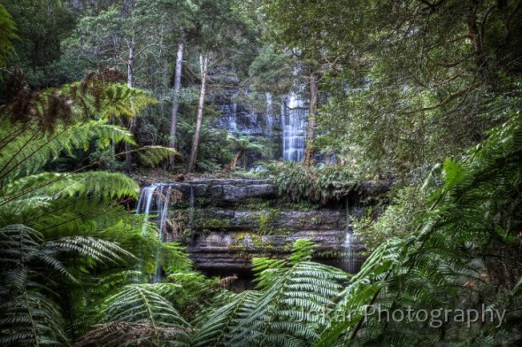
I still keep making High Dynamic Range (HDR) images. I can’t help it. This popular technique involves making a series (usually three or five) images with identical composition, usually on a tripod to ensure an exact alignment of the images. Each one is taken with the same aperture but with different shutter speeds so that you end up with images that may be 2 stops under-exposed, one stop under, ‘normal’, and one and two stops over. You can use auto-exposure bracketing if your camera supports it – but I have to change the settings manually on my camera to achive that range of exposures.

Russell Falls, Mt Field National Park

Russell Falls, Mt Field National Park


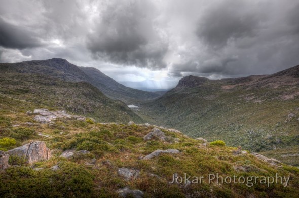
The images are then subsequently merged in post-processing software to create an image which incorporates the full range of light levels in the scene, without any areas of under- or over exposure. The result can be quite natural or quite dramatic, depending on your preference. I find that the technique can turn a scene with flat or uninteresting light into something quite compelling. It is also useful when the range of tones from dark to bright in the image exceed the limited range that can be recorded by the sensor of a digital camera.

View from 'K' Col, Mt Field National Park

View from 'K' Col, Mt Field National Park


You can do the merging in Photoshop (CS5 has good HDR functionality), but I continue to use Photomatix which is a specialist tool for HDR imaging, offering a great deal of control over the appearance of the image created.

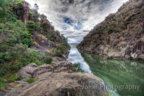
Launceston Gorge

Launceston Gorge


But the technique can be overdone – and often (perhaps usually!) is. It can difficult to resist punching up the local contrast or saturation levels to a point where the effect is hyper-surreal or oppressively garish. Oversaturated, grungy images, which one critic has referred to ‘Harry Potter photos’ are all over photo-sharing sites on the net, and have given the technique a bad name in some quarters. Used with discretion and moderation however, I think it can be brilliant. And sometimes it’s good fun to create that surreal effect.

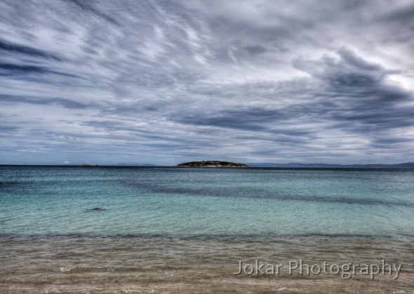
View from our campsite, Freycinet

View from our campsite, Freycinet


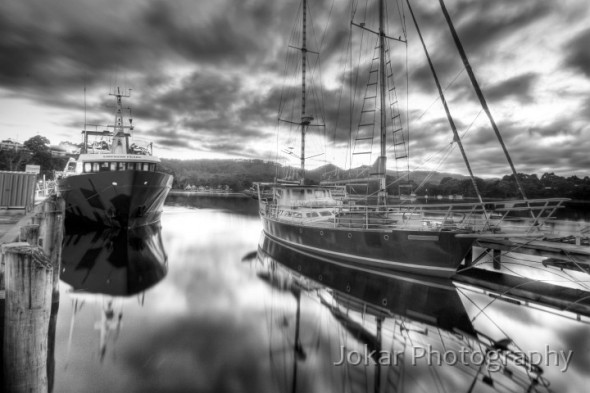
Strahan Harbour

Strahan Harbour

I’ll do some more posts about Tassy later, but in the mean time you can see other photos from Tasmania (only a few which employed HDR!) on my website in this folder. There’s also a folder with a number of other HDR images here. Hope you like them!


Snow camping on the Ramsheads

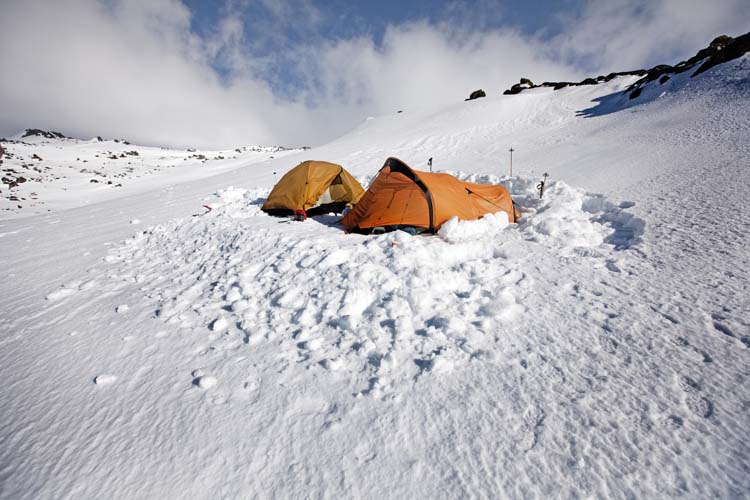
Two weeks ago I had a few days camping in the snow up on the Ramshead Range (between the top of the Crackenback chair at Thredbo and Mt Kosciuszko). Setting out from the top of the chairlift, the wind was blowing across the snow from the west at 60km/hr, so we (friends Colin, Barry and I) decided not to trudge into it on our snowshoes for too long, and agreed to make camp on the leeward side of a biggish granite-bouldered hill. An hour of snow-shovelling later we had a nice flat platform on which to erect our tents, and some protection from the icy wind.

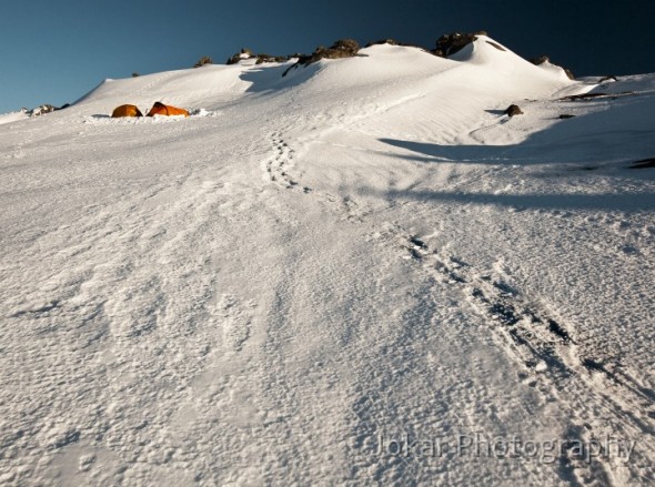
Ramshead camp site

That was our base for two nights, and during the day we explored around the south side of the North Ramshead, and I got into some nice light, views and photos in the early morning. It was unfortunately too cold and blowy for me to attempt the time lapse star trail photos I had intended to make, and we spent quite a bit of time “loitering within tent”.

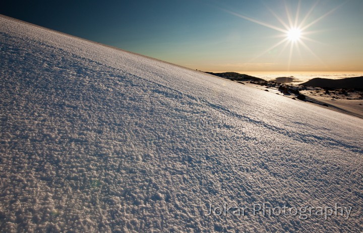
Ramshead sunrise

The full set of photos from this trip can be seen on the main Jokar web site in this folder.

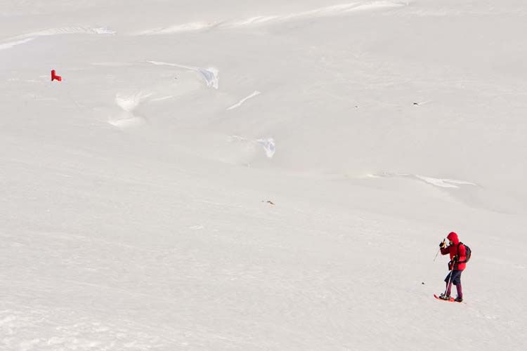
Anyway, despite the windy conditions, it was a lot of fun, and it was a whole lot more clement than our previous outing. Back in August 2008 we (plus Rob) ‘enjoyed’ winds gusting at 130km, and had 90mm of precipitation thrown at us in the form of sleety snow during the second night. On that occasion the tents blew flat and leaked badly, and hypothermia was a real option. Got some nice photos  before the storm hit however, including this one of Little Red Riding Rob descending to the red-painted Cootapatamba Hut.

Little Red Riding Rob

A couple of gear notes:

  1. my Salewa ‘Sierra Leone‘ tent is sold as a “four-season tent”, but really it’s just a comfortable fair weather model, and not very sturdy in strong wind. Next time I’ll be looking for a “five-season tent”.
  2. I doubt that there is any sleeping mat more comfortable or more warm than the Exped DownMat 7. It can be a bit slow to inflate using the carrying sack as a pump, but it’s otherwise just a brilliant piece of lightweight luxury.