Category Archives: Photos

Mahakam River

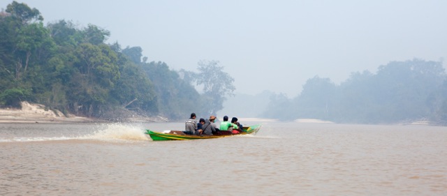
The Mahakam River runs for just under 1000km from the Muller Mountains in the ‘Heart of Borneo’ southeast to the provincial capital of East Kalimantan (Samarinda) and the coastal delta, eventually discharging into the Makassar Strait.
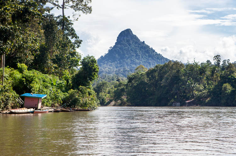
20150506_Sungai_Mahakam_0052

It’s very wide and muddy in its lower reaches, and narrow, almost fresh and punctuated by rapids nearer the headwaters. The Mahakam Lakes, an extensive region of shallow freshwater lakes, some only existing during the wet season, sit near the middle.

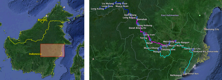
Map-Mahakam-journey

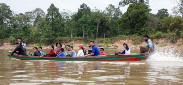
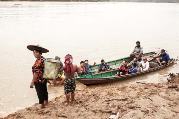
On the map it may not appear that we got far in those ten days. But it’s not an area that can (or should) be rushed – and the logistics of getting around can be complicated. Six hours on local buses to get from Balikpapan to Kota Bangun, three days on motor-powered longboats to explore the Mahakam Lakes, then 41 hours on a local passenger/freight boat to reach Long Bagun, around 14 hours on three speedboats to get up the rapids to Tiong Ohong and back again, and a final all-night car trip (with eight of us in the car) to get back to Balikpapan. But we enjoyed the challenge of organising it all as we went along, and it all came together rather nicely.

20150504_Sungai_Mahakam_0200

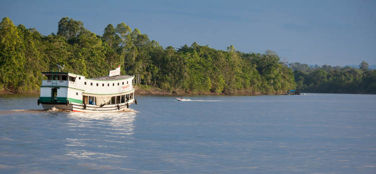
Our longest single stretch of travel was on a ‘kapal biasa’, the main passenger and freight vessels on the river. We spent 41 hours on board, delayed when the spotlight at the front of the boat stopped working, which meant that we could no longer travel at night for fear of colliding with the many large logs floating in the river. We slept on a platform upstairs, where there are spaces for 76 passengers, though thankfully it wasn’t full. Downstairs is crammed with cargo goods being delivered to the many villages along the way, and also with those passengers who couldn’t afford the $25 fare to travel in ‘luxury’ up top.

20150504_Sungai_Mahakam_0179

We really enjoyed the journey, spending much of our time sitting on a little platform up front from where we could watch the river, villages, forest and other vessels pass by. The river meanders continuously, the boat moved slowly with many stops, and the steady hum of the engines made for relaxing and contemplative travel.

However the facilities were somewhat basic. The shared ‘bathrooms’ have less floor area than a phone booth, with a big hole in the timber floor which doubles as the toilet and as the means of bathing. The latter is achieved by repeatedly lowering a small bucket-on-a-rope down into the river below to fetch pails of coffee-coloured fast moving water below with which to wash.

20150501_Sungai_Mahakam_0750

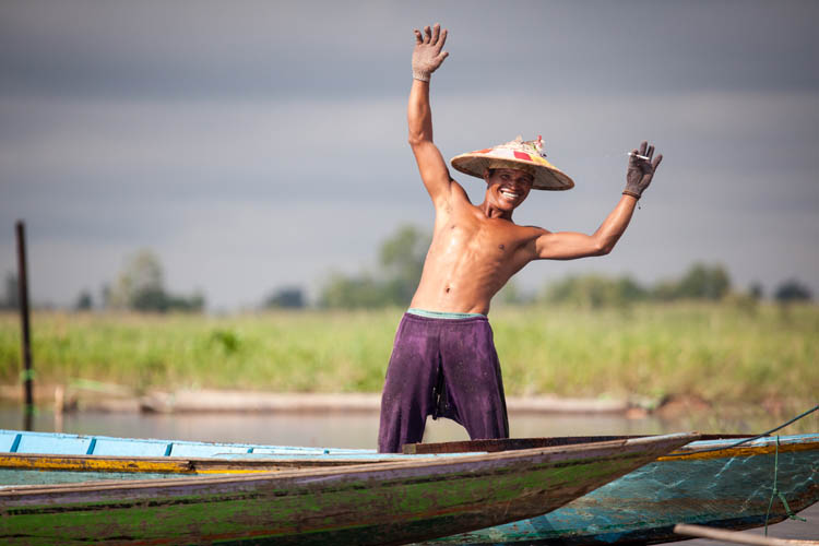
As always there were many people keen to wave to us as we passed, none more exuberantly than this guy who looked resplendent in his typical Kutai-style hat, cigarette in gloved hand. He was one of a team working at a timber mill which was mounted on a floating platform in the river.

20150430_Sungai_Mahakam_1250

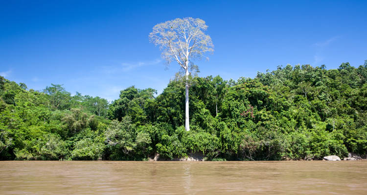
There are plantations (mostly rubber and oil palm) and gardens, but for most of the journey the banks were a wall of forest. Almost none of it is ‘primary’ (undisturbed) forest, with all of the accessible and high-value trees having been removed long ago.

20150504_Sungai_Mahakam_0173

It’s still beautiful, with big trees standing defiantly amongst the smaller trees, vines and regrowth. Bands of monkeys (mainly long-tailed macaques) lurk on the branches.

20150507_Sungai_Mahakam_0038

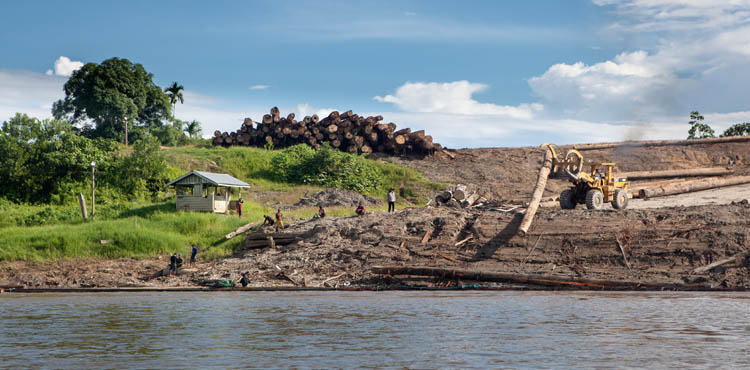
But logging (along with coal mining) is still the major industry up-river. The trees are usually felled some distance from the river, and brought by truck down rough forestry tracks to the river. There is no road to the mills in Samarinda, hundreds of kilometres downstream, so the logs are transported down the river.

20150504_Sungai_Mahakam_0210

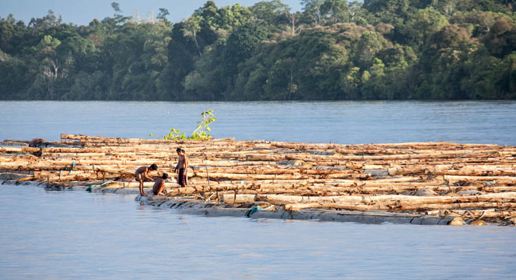
Once in the river, big rafts of timber are constructed by tying logs together with rattan and rope. These rafts can be a hundred metres or more from end to end, and it takes several days to journey to the mills. One or two little boats are used to pull and guide them, and a small team of men ensure that the raft stays tied together. These guys have great balance – falling between two logs could be nasty – and they seem to spend nearly as much time in the river as on it.

20150430_Sungai_Mahakam_1213

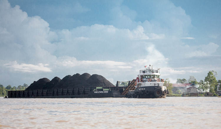
Coal barge heading downstream.

20150505_Sungai_Mahakam_0121

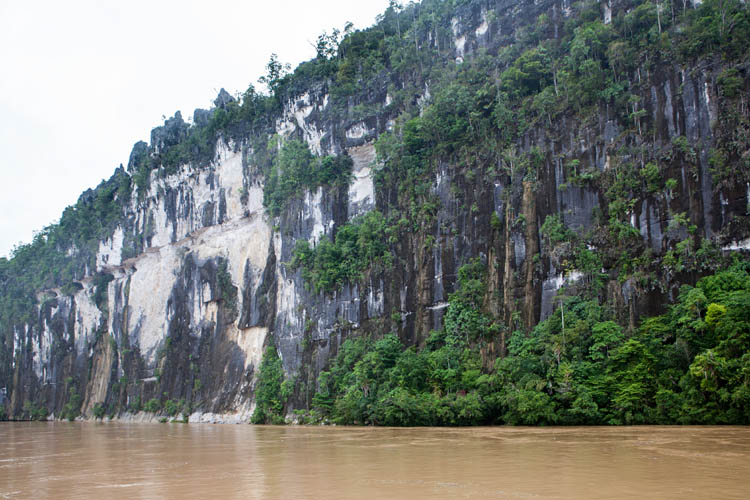
Riverside cliffs downstream from Long Bagun.

20150505_Sungai_Mahakam_0143

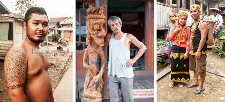
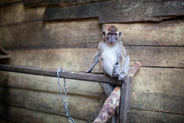
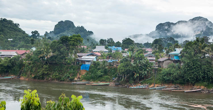
We stayed in Long Bagun village, where the kapal biasa terminates before the rapids upstream. As always, we met lots of interesting and friendly people. Traditional tattoos are still common, and the guy on the left above sported some of the finest dayak motifs we have seen. He seemed a little fearsome at first, until we read the tattoo across his chest which says (in English, a language he doesn’t speak!) “Love my Family”. The bloke in the middle was putting the finishing carving touches to a pair of wooden statues to adorn the front entrance of his home. (He also keeps a angry little pet monkey on a chain, which launched itself at Karen when she got close.) We met the couple on the right as they began their wedding ceremonies by visiting the homes of all of their family members in the village.

20150505_Sungai_Mahakam_0149

Angry little pet monkey.

20150507_Sungai_Mahakam_0003

The last village we stayed in was Tiong Ohong. The six hour speedboat journey there from Long Bagun was sensational, negotiating several rapids, through deep gorges and deep forest. The rapids were pretty exciting, particularly after we were told about the boat that capsized a few months previously with the loss of three lives. We were quite happy to put on the bulky lifejackets offered to us.

20150506_Sungai_Mahakam_0079

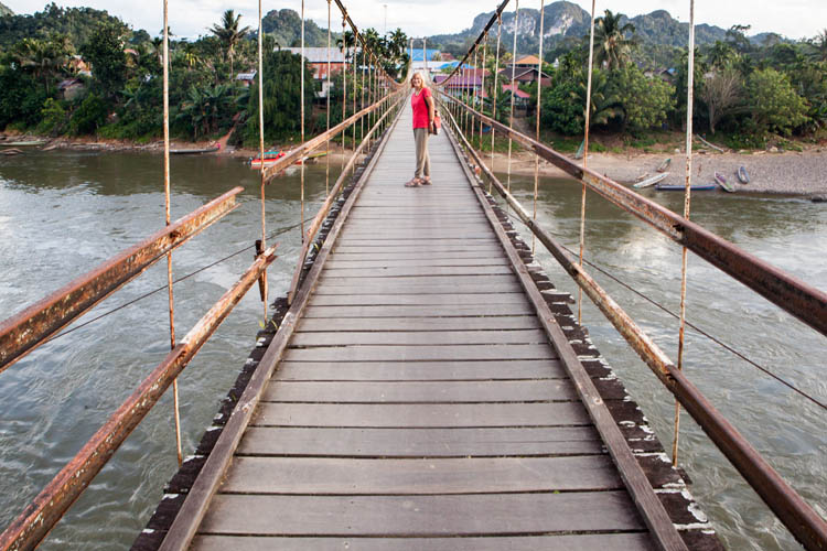
Tiong Ohong is actually two villages, (Tiong Ohong and Tiong Bu’u) facing each other across the river, with a suspension bridge connecting them. You cling to the side rail when motorbikes cross over.
The village is also the base for the seven day ‘Trans-Kalimantan Trek’, a very tough wet trudge through jungle and over the Muller Mountains to the Kapuas River in West Kalimantan. Mud, leeches, spiky vines and dozens of river crossings. People who have done the trek express ‘grim satisfaction’ on completion, and we are yet to find reports of anyone actually enjoying it.

But we stayed on the river, returning from Tiong Ohong to Balikpapan over the following two days, and we enjoyed every minute of it.

20150502_Sungai_Mahakam_0334

Manugal – planting rice with the Dayaks

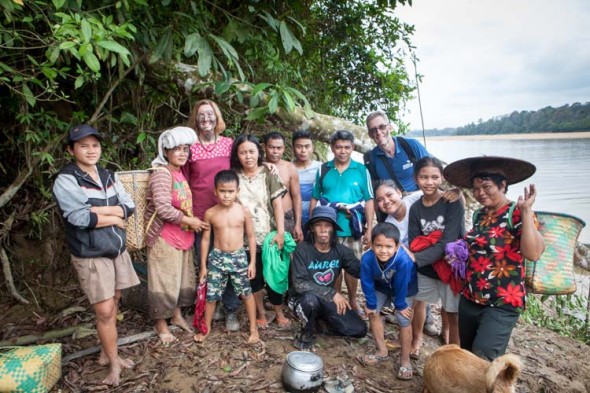
A couple of weekends ago, our new friend (and workmate) Lelie very kindly invited us up to visit her village of Tewang Rangkang, on the Katingan River about 80km (or 2 hours) to the northwest of here. It’s a Dayak Ngaju village. (The indigenous people of Borneo, especially the interior parts of the island, are collectively known as Dayak people, and the Ngaju people are one of the many sub-groups). The occasion of our visit was for a ‘Manugal’ ceremony and working-bee.

Tewan_Rangkang_20141025_0185Gotong royong and Manugal. Across Indonesia, the practice of ‘mutual cooperation’, where a community all pitches in achieve some goal that is too big for an individual to do on their own, is very much alive. Think ‘barn-raising’. They call it gotong royong, and it’s part of the national ethos (although the concept got hijacked for political purposes by both Sukarno and Suharto).
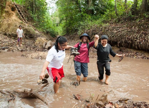
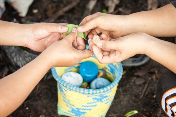
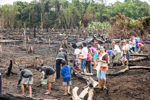
Amongst the Dayak people, who still practise slash-and-burn dry rice cultivation in forested lands (ladang), everyone pitches in to help their family and neighbours to clear land for cultivation, and to plant and harvest the rice. The ceremony and working-bee at the time of planting the rice is known as Manugal.

Tewan_Rangkang_20141025_0035

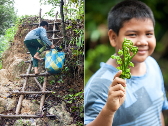
To get to the ladang fields, we first had to walk through the village and across the sandbanks to the river’s edge. Some small motor-powered canoes (‘ces’) were waiting to ferry us across the river, where we climbed up muddy banks and ladders, then through forest, plantations of durian, bamboo and rubber trees, and finally across a rather bleak terrain of recently cleared and burnt countryside. This was where the rice was to be planted.

Tewan_Rangkang_20141025_0168

By the time we got there (about 8am) there were around 40 people assembled under a tarpaulin shelter on the edge of the field. Bags of rice were measured out into baskets to be carried by each of the planters – white, red and yellow rice. Everyone took a taste of sirih – betel leaf, areca nut and lime paste – to chew on as they started work. We walked out into the burnt field, spitting red as we went.

Tewan_Rangkang_20141025_0054

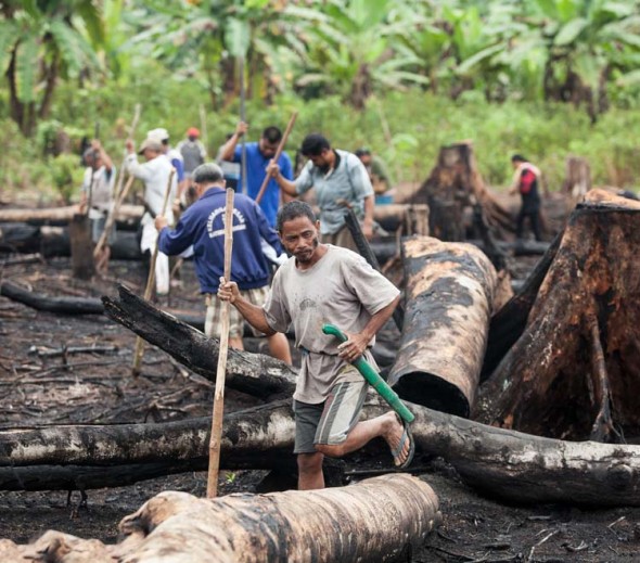
The men each took a wooden staff, sharpened at one end, and formed a loose line standing about two metres apart. We worked our way across the field. making shallow holes in the ground as we proceeded, twisting the poles to form a roughly conical depression every 30cm or so.

Tewan_Rangkang_20141025_0057

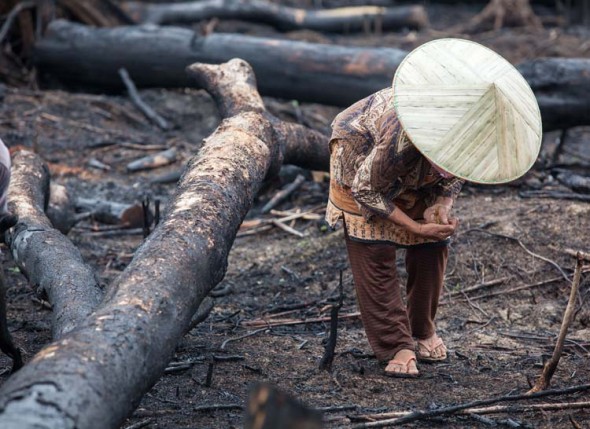
The women made a second parallel line, sweeping across the field behind the men, and dropping about 10 grains of seed rice into each of the holes. It is all pretty rough and basic: the seeds aren’t covered at all, or watered in. In fact the crop is not irrigated at any stage, relying on the (usually reliable) rains from November to February to sustain the crop.

Tewan_Rangkang_20141025_0126

At the end of the plot (ownership boundaries are marked with string) everyone moves across to the next strip and repeats the process until the whole area is done. There are stumps and logs all over the field, and you just clamber over them and plant around them as best you can. It’s not worth investing in full-on clearing, because the whole area is abandoned after a few years, or converted to growing rubber.

Tewan_Rangkang_20141025_0099

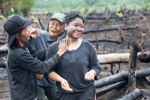
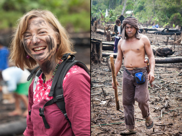
The work was done with a lot of humour and laughter, and sometimes seemed to be more about bonding the community than getting the job done. Everyone got their faces smeared with charcoal at some point in the day, and there were breaks for coffee, fried pork and rice, and sweet cakes (all delicious).
Tewan_Rangkang_20141025_0081

Even with the breaks, we were all finished by about noon. Just as well, as the day was getting seriously hot by then. Members of Lelie’s family, especially her sister and one of her uncles, spent a lot of time explaining things to us – as well as they could with our limited Indonesian language and non-existent Dayak Ngaju!
Tewan_Rangkang_20141025_0136

So then it was time to pack up and head back the way we had come, no longer too concerned about keeping our clothes (and faces) clean. We knew there was a mandi and a change of clothes waiting back in the village.

Tewan_Rangkang_20141025_0175

The mood was very relaxed on the way back, everyone seeming content with the morning’s (modest) work effort. There was much hilarity as the three ces raced across the river, each driver trying to spray the other boats in their wake. Halfway across I was asked if I could swim. “Yes”, I replied. “But my camera can’t”. This meant I got excused from the all-in splashing and dunking battle that erupted as we reached the home shore.  Tewan_Rangkang_20141025_0173 

We stayed back in the village for a wash, lunch, and to meet some of Lelie’s huge extended family. (Our standing joke is that she doesn’t have a pohon keluarga (a ‘family tree’) like most people – instead she has a hutan keluarga (a ‘family forest’)!

As we headed back home later that afternoon, feeling warm inside from all the hospitality (and good food!), we had no idea that we would be back for a three-day visit less than a week later. But that’s a story for another time.

Idul Adha in Marang village

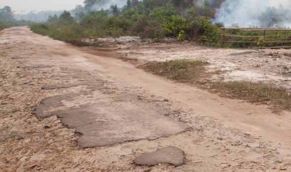
A few weeks ago we were invited to attend an Idul Adha event in the (mostly Javanese Muslim) village of Marang – about 20km from here. We rode our little Yamaha Jupiter to the village, bouncing along very slowly on the broken sandy ‘main road’ into Marang. The road, like most roads other than the Trans-Kalimantan Highway, was bitumen once (perhaps a few hundred years ago?!) but is now largely broken and potholey, with a narrow smooth sandy strip along the edge where motorbikes can get through.

Jalan-rusak

Idul Adha (or Eid al-Adha in Arabic) honours Abraham’s submission to God’s demand that he sacrifice his son Ishmael. God was satisfied with Abraham’s submission, and let him sacrifice a lamb in place of the (no doubt relieved) Ishmael. I’ve had the first verse of Dylan’s Highway 61 going round in my head all month!*

Marang_Idul_Adha_20141005_0005

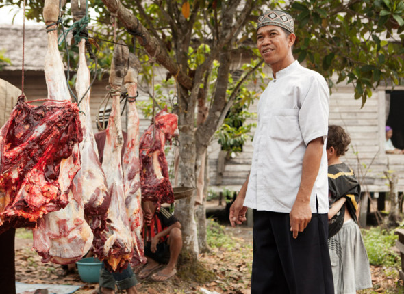
The event is commemorated amongst Muslim communities world wide, with each year around 100 million animals (sheep, goats, cattle, camels) sacrificed and shared with family, friends, neighbours and the poor. It’s a feast day, and for many people in this area, it’s perhaps the only time they get to eat meat (other than chicken) all year.  Beef is expensive, around the same as Australian prices – but the cost of one beast is about about equivalent to the average annual income here!

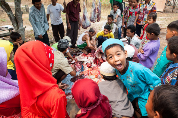
Marang_Idul_Adha_20141005_0042

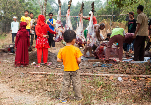
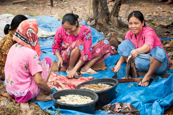
Marang is a poor village, but there were two cattle and a goat slaughtered, in an open area beside the masjid. One of the cattle was a gift from the Mayor of Palangkaraya, and one was provided by YUM (the Yayasan Usaha Mulia, for who I am working). Apparently YUM donates an animal to a different village each year.

Marang_Idul_Adha_20141005_0083

The event was more of a community butchery session than an overtly religious event. We arrived at 9am, and so we missed any ceremony that may have occurred before our arrival. We had read that Idul Adha is an occasion for everyone to wear their very best clothes, so we fronted up in   the best that we have, batik and leather shoes etc, to find that most (but not all) of the villagers were very sensibly decked out in clothes suited to work in a slaughterhouse!

Marang_Idul_Adha_20141005_0068

All of the adults participated in the work, with clear demarcation of responsibilities – but no-one seeming to be in charge, or giving orders. We see this repeatedly, how the logistics for events just seem to work with a whole community working seamlessly towards some common goal. The animals were very efficiently slaughtered, skinned, chopped up, cleaned and hung, with much good humour and laughter.

Kids

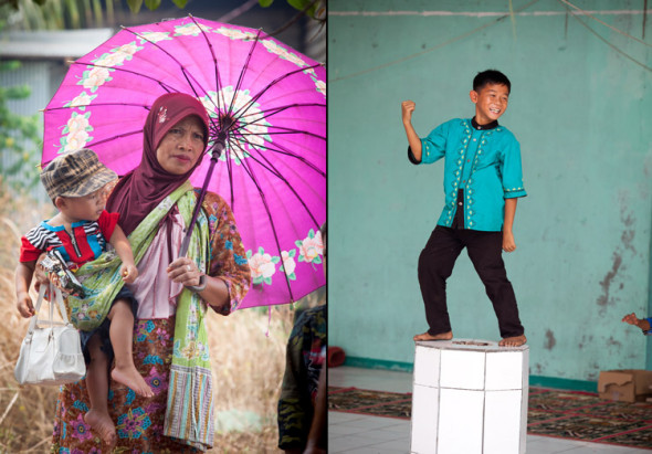
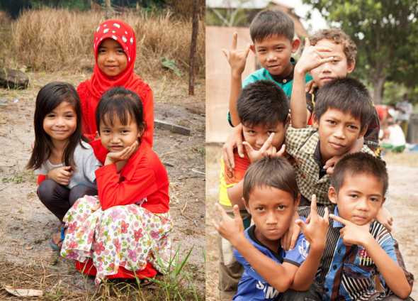
We, the only bules (westerners) in attendance, were made to feel very welcome, and a mat was laid out for us to rest in the shade of the masjid when the day started getting real hot. As always, the kids were very interested in us, wanting to ask questions and pose for photos.  All on their best behaviour – perhaps because the adults of the village were all nearby, wielding large sharp knives?!

Marang_Idul_Adha_20141005_0025

 * Oh, God said to Abraham: “Kill me a son”
Abe said: “Man, you must be putting me on!”
God said: “No”
Abe said: “Why?”
God said: “You can do it if you try.
Or the next time you see me coming, you’d better run”
Abe said: “Where you want this killing done?”
God said: “Down on Highway 61″

Smoke gets in your eyes


Bukit_Batu_20141004_0007
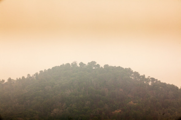
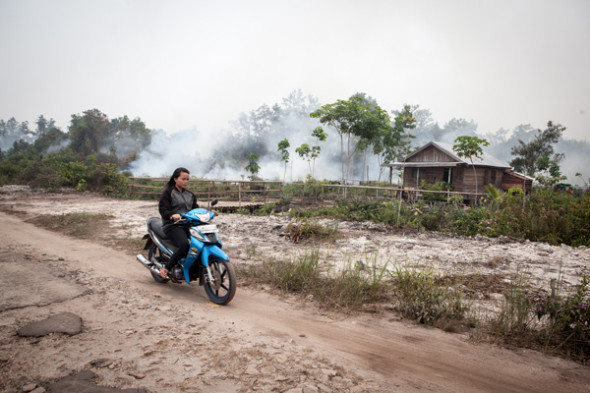
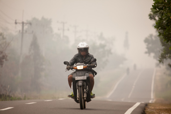
It’s the tail-end of the Dry Season (Musim Kering) here in Central Kalimantan. Here (and in parts of Sumatra) it’s also known as Musim Kebakaran (‘the Burning Season’), because of the prevalence of man-made fires in the forest and farmlands. From piles of rubbish and raked-up leaves, to garden plots, scrubby farmlands, entire forests – it seems like the whole landscape is being progressively turned into smoke and ash. Even the ground is smouldering in places, because much of  it consists of dried-up peat swamp, often metres deep, and once fire gets a hold … it just keeps burning.

Marang_Idul_Adha_20141005_0090

The Dayak people have always used fire to clear small areas of forest in preparation for planting dryland rice and vegetables. But it was done on a small scale. Now everyone, not just shifting cultivators, is doing it. With much larger-scale cultivation of plantation crops (particularly oil palms), very large areas of both primary and secondary growth forest are being cleared, by chainsaw and fire. Indonesia has now overtaken Brazil as the ‘world leader’ in deforestation. And the fires have become an international issue, with Malaysia and Singapore complaining every year about the massive smoke clouds drifting over from Indonesia.

Tangkiling_asap_20141012_0020

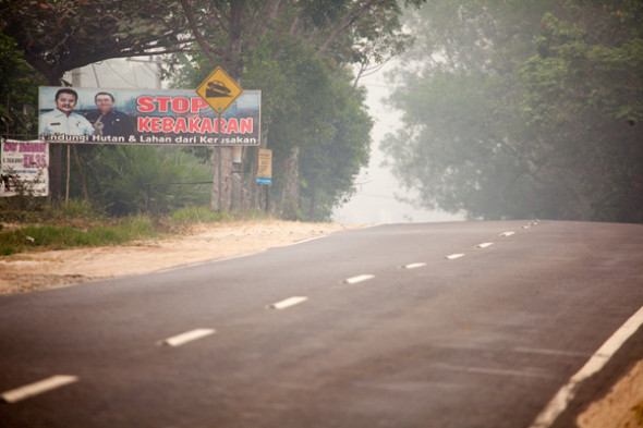
Most, if not all of the fires are illegal, and national and regional governments regularly announce crack-downs, prosecutions and punishment of offenders. There’s even a website that uses high-res satellite imagery to give live updates of ‘hotspots’ across the archipelago. However, a just-completed independent audit of the 17 largest forestry firms in Riau found that none of them (not one!) managed even a 50% score for compliance with the regulations. Along the Trans-Kalimantan Highway which is our main road here (locally known as Jalan Tjilik Riwut), there is an anti-fire billboard every few hundred metres. They proclaim, alongside a picture of the provincial Governor: “Stop Fires! Protect forests and fields from damage”. There’ll often be a smoking or burning field behind the billboard.

Tangkiling_asap_20141012_0036

In Sumatra, the government has taken to handing out face-masks to passengers as they arrive at the airports. Here the Palangkaraya airport is often closed because the smoke is too thick for pilots to land their planes. Pre-schools have closed, and primary schools were all closed for two days last week. Vehicles drive with headlights on throughout the day.

Bukit_Batu_20141004_0011

We actually haven’t been affected too much by the smoke haze. It seems to have a cumulative impact on the health; some of the expats who have been here for the longest are suffering more than us, with several going to places with clearer air (like Bali – or even Jakarta!) for relief. Local people (by and large) don’t have that option, and so endure by being stoic.

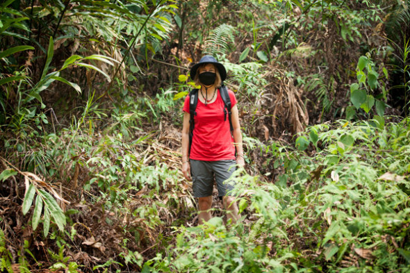
We have air conditioning in our little house, and that helps a great deal. We also wear good quality masks when travelling on the motorbike, and when hiking. It has a certain ‘bandit chic’ about it, don’t you think? Nonetheless, we ARE looking forward to the arrival of the rains (probably within the next month), because that will spell the end of the Burning Season, and the end of the smoke…

Solo_20140823_0144

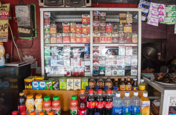
And, speaking of smoke, could it be that attitudes to tobacco smoking are changing? When we were here five years ago, I remember reading that 70% of adult men in Indonesia smoke every day (women almost never smoke), and that there were some 5 million people working in the tobacco industry (as growers, hand-rollers of kretek cigarettes, distribution and sales etc). That made the industry a pretty powerful lobby, and there seemed to be little push to reduce tobacco consumption. Now you can still buy and smoke cigarettes anywhere and everywhere, though the price has gone up to about A$1.60 per packet of 20 (i.e. around 10% of the price in Australia, often for the same brands). Advertising for cigarette brands is still seen everywhere (on billboards, shop banners, posters), often with those absurd Marlboro Man / James Bond / Racing Car images, and words like ’smooth’, ’taste’, ‘mild’, ’satisfaction’ and ‘fresh’.

But there doesn’t seem to be as many people smoking as there were five years ago, and cigarette packets now carry warning pictures – mostly Grim Reaper-style images, and some of the graphic diseased-tissue photos as on Australian packets. We hear people acknowledging the negative health impacts of smoking – five years ago there were people telling us that smoking is good for your throat and lungs! My work colleagues were joking recently about the foolishness of people who assiduously wear smoke masks all day, only taking them off in order to have a cigarette!

Kanarakan village

Kanarakan_20140925_047

Last week I went north up the (Rungan) river with some of my new workmates to check on the condition of home gardens in the village of Kanarakan, which has no road access. It’s still the dry season, so the river is low, the gardens are currently ‘resting’ (i.e. mostly dead), and the air is always hot and thick with smoke from the burning of forests all over Kalimantan. But it was a great day, really enjoyable and interesting. Very comfortable travelling in klotoks (canoes with outboard motors). Keep the camera dry!

Kanarakan_20140925_019


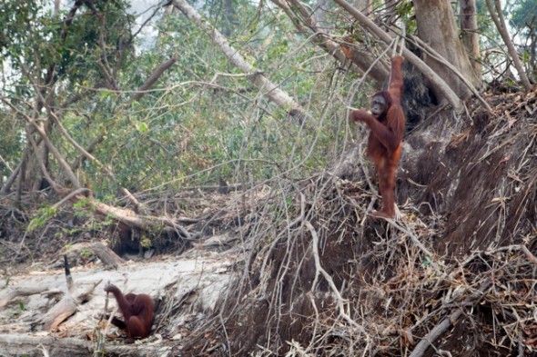
There were monkeys and even a couple of orang-utans to see along the way. The orang-utans live on a large-ish island in the river in a ‘rehabilitation centre’ preparing for later return to the ever-diminishing forests. There are security posts across the river from the island to ensure that they don’t get disturbed by visitors or hunters.

Kanarakan_20140925_066

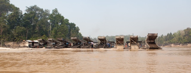
The only human signs of life along the river were a few fishermen, and a lot of the floating gold-mining dredges. Most (all?) of the mining platforms are unlicensed (illegal) and they use mercury to extract the gold from the sediment. They leave big piles of sand where they have been working, and they are a major reason for the declining health of the river systems here.

Kanarakan_20140925_072

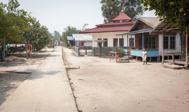
The village of Kanarakan consists of just one road along the riverbank, no cars and only one or two motorbikes all day while we were there. It’s a mixture of Dayak (Protestant Christian/traditional Kaharingan religion) and Javanese Muslim people. Across the road from the masjid is a church, with a Dayak spirit-house next door to it. The 300 or so villagers get a meagre living from the river (fish or gold mining) or the forest, where they collect rattan and some kind of wood that they tell me is used in Chinese cosmetics (?). I read somewhere that 93% of the people in this district live on less than US$2 per day.

Kanarakan_20140925_123

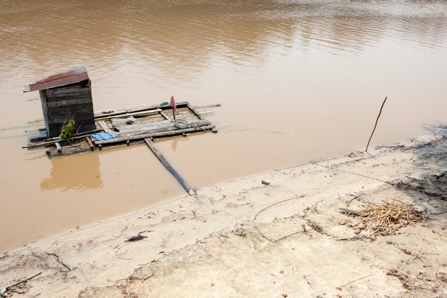
Every house has a floating platform down on the river. It’s where they moor their klotoks, bathe, do the clothes washing and, in the little floating outhouse which is missing a plank in the middle, go to the toilet. That’s a pile of the Chinese cosmetic wood in the lower right of the picture.

Kanarakan_20140925_091

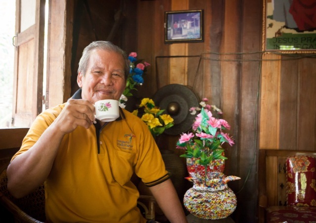
We were invited in to have coffee with the kepala desa (village head), the warm, gentle and talkative Pak Anden. His coffee is grown out the back of his house, and he flavours it with a mixture of six spices, including ginger, cloves and cinnamon (I forget the other ingredients, but it was very nice…) When I told him where I came from, he said (in Bahasa) “Oh yes, I have had other visitors from Australia”, and got out his photo album with photos of Harry Jenkins and Bronwyn Bishop when they were there on a parliamentary delegation a few years ago. Sometimes the world feels too small.

Kanarakan_20140925_149

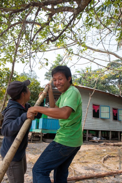
We had a hot but easy amble around the village gardens, most of which have nothing growing as everyone waits for the start of the wet season. The gardens are located about 10 metres above the river level, so any water for the gardens has to be carried up in buckets. There is a project under way to construct some water tanks, and the village should have road access within the next year or two. At one point Sumarlan and Erna got a long bamboo pole to collect some kedondong (ambarella fruit) for me to take home for Karen.

Kanarakan_20140925_155

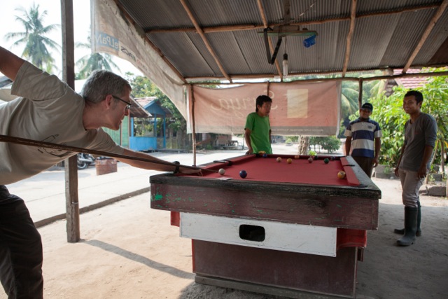
After lunch and some more garden inspections, we had time for a few games of ‘billiards’ (though it was really pool, with a half-size cue ball). Each player chooses four playing cards from a deck, and then has to sink the balls that match their cards. I won! (Now they want me to join them for volleyball…)

Kanarakan_20140925_198

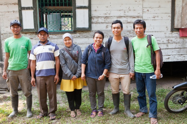
Some of my new workmates – Joko, Agus, Erna, Memey, Novi and Sumarlan. A great team, friendly, generous, and all good workers too, doing really worthwhile stuff. The ‘Agro’ team are helping to establish home veggie gardens, teaching nutrition and cooking skills, and experimenting with fish-farming, worm culture, compost recipes and ‘integrated pest management’. Other parts of the YUM organisation are running after-school classes and library services, and a vocational training centre (computing, sewing and English language classes). More about the workplace and the various projects at a later time…


Independence Day, Jogjakarta

Jogjakarta_20140817_0030

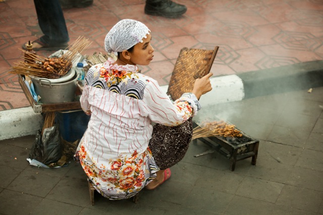
Chicken sate vendor, Jogjakarta

Chicken sate vendor, Jogjakarta. It was 17th August – Independence Day – and the streets and footpaths of Jogja were streaming with people out be part of the festivities for the big day. Families with little kids waving their red-and-white flags lined up to see the parading soldiers, important looking dignitaries making speeches, gamelan orchestras, brass bands and drumming troupes, acrobats and school choirs.

In amongst it all the street vendors seemed oblivious to the occasion. This woman squatted on the edge of the road, with the crowds flowing past her like a rock in the river. She fanned the embers of the coconut husk fire to cook the sate slowly, turning the skewers and looking around all the time for potential customers. The smoke wafted around, and smelt delicious, but no-one was buying.

Jogjakarta_20140817_0006

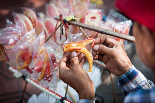
Sweet vendor, Jogjakarta

Sweet vendor, Jogjakarta. Another fellow was hand-making sweets out of sugary paste and food dyes, shaping the goo into elaborate shapes of dolphins, swans and butterflies, before putting each one onto a stick and sealing it in a little plastic bag. I didn’t see him get any sales in the hour or so that we stood nearby, but he seemed to be totally engrossed in his craft.

Jogjakarta_20140817_0008

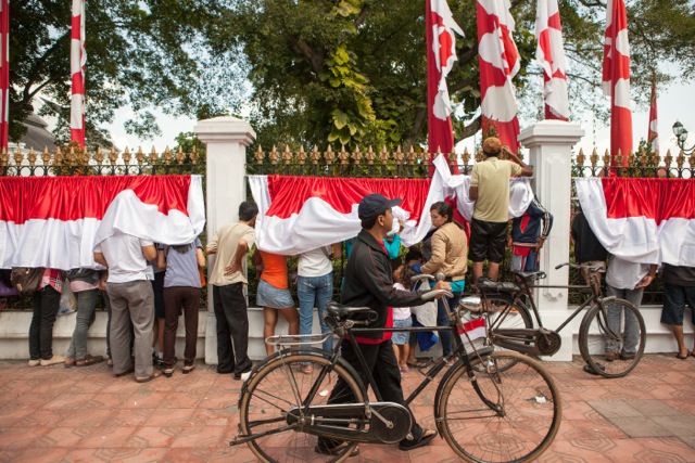
Outside the Ceremony, Jogjakarta

Outside the Ceremony, Jogjakarta. The main ceremonies for Hari Kemerdekaan (Indpendence Day) in Jogja were conducted behind a high fence in the palatial grounds of the local government official residence. Hundreds of VIPs, guests and military personnel were inside, but the masses of the general public could only look in from outside the grounds.

Turtle Nesting, Mallacoota

I find it useful to allow pictures to ‘cure’ for a time before deciding which ones I like. Sometimes the images that appeal most at first viewing don’t survive the passage of time and re-viewing. Too obvious, too garish, too shallow, too derivative – there’s a host of reasons why an image that at first seemed to be a ‘keeper’ later seems uninteresting. Or even embarrassing.

But others emerge from the archive after being neglected at first glance. Or else I find myself going back to look at them or work on them some more to try to reveal some hidden potential. Perhaps it is just that my taste changes over time.

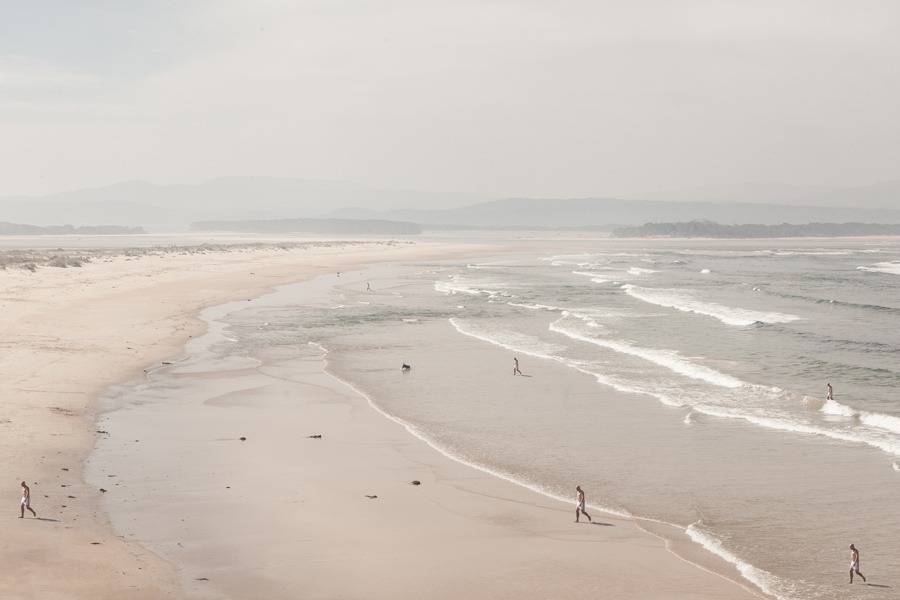
Anyway, here’s a picture from March 2013 that I’d put in that second category – of emergent keepers. The scene was captured at Mallacoota on the ocean beach, on a hazy afternoon with pale sunlight filtering through sea spray.

Turtle Nesting, Mallacoota (2013)

Turtle Nesting, Mallacoota (2013)

I liked the man emerging from the surf in his white swimming trunks. As I worked on the image in Photoshop, I came to imagine him as some kind of amphibian creature arriving from the deep ocean, rather than just an ordinary bloke who’d gone out for a quick dip in the surf on a warm day.

I cloned him several times to create a ‘troop’ (a ‘flotilla’, a ‘school’?) of identical figures all reaching land simultaneously. The waves and the walking men give a nice strong feeling of movement from the right to the left side of the picture. It was late at night when I worked on the image, and I drifted into thinking of those high school science pictures showing the evolution of life as sea creatures started colonising the land. Then of some kind of aquatic zombie invasion. But mostly, I imagined sea turtles during their seasonal arrival to lay eggs in beach dune nests.

On the day when I first arrived at the headland and looked along the beach towards the inlet, the light and framing of the scene had me thinking of the quality of light in the beach photography of Massimo Vitali, whose work I had recently been looking at.

Massimo Vitali - Vecchiano Venditori, Italy

Massimo Vitali – Vecchiano Venditori, Italy

And later, when I came to work on the RAW file to produce the final image, I found more inspiration in the luscious, painterly beach images of Belgian photographer Harry Gruyaert. He has employed much darker tonality than the light-saturated, almost washed out images of Vitali (and my own picture). However I really like the stagey compositions, elevated angle of view and big skies, all accentuating the perspective of the beach stretching away to the horizon. (Click to see more of his work on the Magnum photo site)

Harry Gruyaert. Picardie region. Bay of the Somme river. Beach of the town of Fort Mahon. 1991.

Harry Gruyaert. Picardie region. Bay of the Somme river. Beach of the town of Fort Mahon. 1991.

The Turtle Nesting, Mallacoota picture was made as part of my project on South East Coastal Adaptation – you can see other pictures from the series at this link.

Future Landscapes VII: Flight

Pelican Flight

Pelican Flight

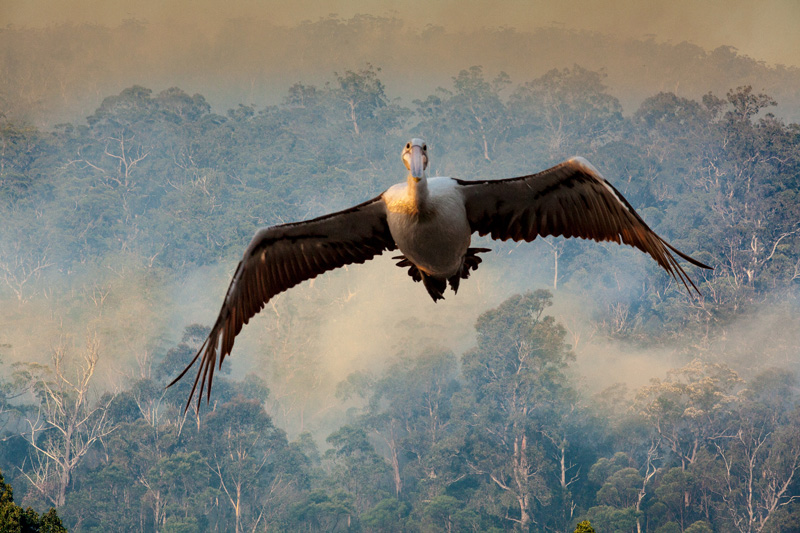
This image is a composite of two photographs. The background was taken inland from Merimbula, during a day of preventative back-burning. Dense smoke clouds emerged from many locations in the forest (part of the Southeast Forests National Park) and wafted over the treetops and nearby rural properties. There was a strong smell of smoky eucalyptus, and the atmosphere was lit with a glowing golden-brown haze. The pelican was photographed several hundred kilometres away (and several months earlier) in sunset light at Marlo in Gippsland. I processed both images with extra-warm white balance (about 6500oK), and applied some graininess to both images to accentuate the gritty sepia tonings.

I was thinking at the time of the impact of human intervention into the landscape, and the drastic changes that this has brought to the life of birds and animals of the region. I imagined the pelican fleeing the terror of the fire, and looking (accusingly?) out of the frame at the viewer. The same concept motivated the Echidna flight and Humpback flight images.

Echidna Flight

Echidna Flight

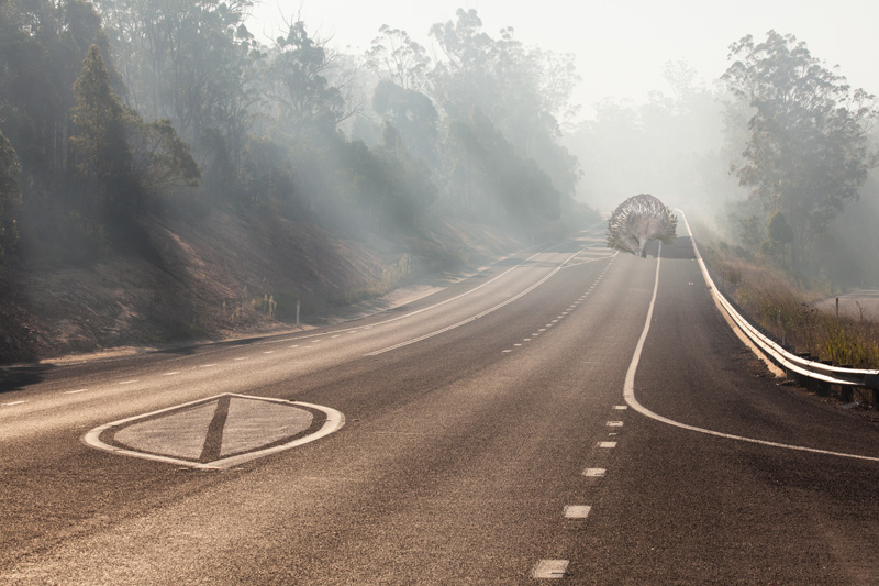
The background image depicts the Princes Highway near Merimbula, at the junction with the Yellow Pinch Road. It was taken in an autumn mid-afternoon, during burning-off operations in the adjacent forest. The light through the trees was filtered by the smoke, which also produced a hazy coppery light, almost (but not quite) like the warm light of sunset. The echidna was photographed a little before dawn (the following day), at Haycock Point in the Ben Boyd National Park, south of Pambula. Uncharacteristically for echidnas, he (or she?) seemed relatively unperturbed by my presence, and posed happily for some photographs before ambling away.

Like the Pelican flight image, this composite image was inspired by my thoughts of ‘wildlife’ fleeing from human disruption of their habitat. The massive size of this ‘mega-fauna monotreme’ is intended to suggest that it not just an individual creature, but is somehow representative of the species, or of native creatures in general.

Humpback Flight

Humpback Flight

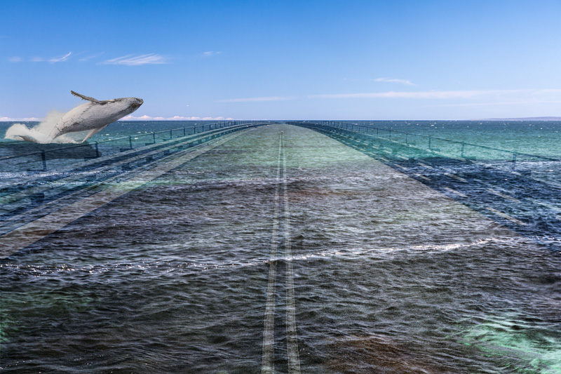
A three-image composite. One of them – the background of ocean and sky – is itself based on another five separate images, combined as a high-dynamic range (HDR) image to give the scene a more dramatic, graphic sort of look. This was taken in early morning light in the Ben Boyd National Park. The ‘road’ is actually a wharf, extracted from a picture of the Edrom Point naval facility on Twofold Bay. Although humpback whales are seasonally prolific along the far south coast of NSW, I was in the region during autumn, when they are not around. So the whale in this image is one that I photographed in June 2012 in King George Sound, near Albany, Western Australia.

There can be few sights in nature as powerfully exhilarating as the sight of a breaching whale. After the near-extinction of many whale species during the 19th and 20th century commercial whaling, whale numbers are strongly recovering in the region. Twofold Bay was the site of a number of whaling stations, which operated until the last one (Davidson’s) ceased in 1929. Now the boats head out from Snug Cove at Eden for the purpose of watching (rather than catching) whales.

As with the other ‘Flight’ images (Echidna flight, Pelican flight) I wanted to allude to the disruption of habitat by human activity. In this instance the whale’s exultant launch into the air looks to be heading for a hard landing.